Hurricane Matthew: Southeast Florida Vulnerable

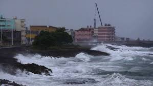
Within hours, Hurricane Matthew will smash its Category 4 chaos on the narrow, flat peninsula that is the State of Florida. And here I sit, safe from this destructive powerhouse about which many in my area remain blissfully unaware; writing from my porch in tiny West Bend, WI. Despite this distance, what I know from research is that, while the evacuation of humans from the highest-risk areas may prove effective in saving lives, in every other way Florida cannot possibly be ready for this.

Category 4 is massive. It has been over 100 years since a Category 4 hurricane hit Florida.

Hurricane Matthew Slams Into Bahamas

And that was the ONLY time.

The deadliest hurricane on record happened in Galveston, TX, in 1900. That hurricane? Category 4.  To add perspective, Hurricane Katrina — infamous for its horrific explosion on the City of New Orleans — was Category 3.

The only Category 5 hurricane to hit the USA was Andrew, in 1992. Fortunately for Florida, Andrew did not dump loads of rain. Why? Because the dikes holding back Lake Okeechobee can handle heavy winds and fallen trees. Excessive amounts of rainfall? Not so much.

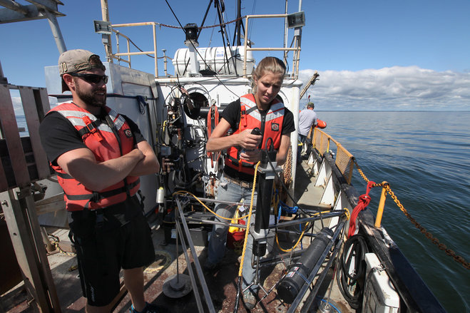
According to Lloyds Emerging Risk Team, Southest Florida’s Lake Okeechobee – roughly the size of Rhode Island —  is the second most hurricane-vulnerable place in the United States, right behind New Orleans. Eventually, the Lake’s dikes can contain only so much water.

Currently, according to Florida Fish & Wildlife Conservation Commission (FWC), Lake Okeechobee’s depth sits at near-record averages of about 15.5 feet:

“Okeechobee water levels continue at almost record highs after an extremely wet summer and fall. The current water level on Lake Okeechobee as of September 25, 2016 is 15.66 ft. NGVD, just over a foot higher than last year. The lake level has increased almost a foot within the last month.”

Hurricane Matthew will drop at least 7″ of rain into the Lake, causing a rise of perhaps 2-feet. It is possible Matthew will pour 10″ or more — and that could create as much as a 3-foot rise.

The lowest of Okeechobees dikes rests at slightly higher than 18 feet — uncomfortably low with Hurricane Matthew approaching, according John Campbell of the Army Corp of Engineers.

Parts of the Herbert Hoover Dike that surrounds Lake Okeechobee start to become vulnerable at 17.5 feet, Campbell noted. 

“Certainly our concern all year is what happens if we get a lot of precipitation and the lake level rises,” Campbell said. “A (rise over 17 feet) would take us to areas where historically we’ve had some challenges and it’s certainly something we’d like to avoid.”

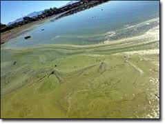
An unfortunate byproduct of Hurricane Matthew may be that the historic HABs (Harmful Algae Blooms) of 2016, which wiped out most of Southeast Florida’s Gold Coast tourist season, will repeat themselves in 2017. Hundreds of millions in tourist dollars will again be at stake.

For area businesses who rely on tourist trade, this loss of income would clearly be devastating.

That said, if Matthew causes a breech to a significant piece of the Lake Okeechobee dike — and this possibility is at present razor-thin close — Southeast Florida will be looking at a disaster reminiscent to what we saw in New Orleans, with Hurricane Katrina.

In two days, we’ll know.


HAB Activity? Follow The Herd ….

I got curious today, after considering poor Toledo, Ohio’s ongoing battle with Harmful Algae Blooms (HABs) in its Western Lake Erie drinking water source. And so, I posed a question: In OH, and WI, where are the preponderance of HABs? And, accordingly, where is the heaviest dairy production?

At the risk of making you, the reader, dig deep to find the information I gathered, I am going to here and now provide you with links to my reference articles:

Western Lake Erie Algae Bloom Projections

2007 State of OH Concentration of accepted Dairy Farm Permits (>700 cows)

Milk Production By County, Wisconsin, 2014

Toxic Algae Blooms On The Rise

And now, the unsurprising results from this search: wherever HABs are most impactful on a large scale (see: Toledo; see: The Green Bay of Lake MI), the largest presence of dairy cows and

UW-Milwaukee Students Sample Green Bay Waters

milk production are either already dominant within the state (WI) — or are trending heavily in that direction (OH).

If best-practice standards for farmers remain marginally regulated, and farm operation regulations pale in comparison to what is required from municipalities, HABs will become an increasingly regular event with corresponding intensity.

In other words … this crappy situation is only going to get worse.


CA algae blooms explained in Door County WI

Over the past few days. I have been struggling to find a clear explanation for the HAB (Harmful Algae Boom) that has overtaken Silverwood Lake, which is fed by the Mojave River, in Southeast CA. Then I happened upon a part-time resident of Door County, WI — one of the Midwest’s premier vacation spots– who was lamenting to me about the well-known, on-again-off-again HAB issues this beautiful area has experienced.

“We are told that our children can swim in the water,” she said, “and then … they can’t.”

Her frustration was palpable, and in it I found my answer: sometimes HAB can be explained when ALL elements work in balance to affect a Lake.

Animals are at particular risk with HAB

Silverwood Lake is unusual in that it is deep. Almost 170 feet at its deepest. But it is NOT unusual in its vulnerability to the primary factors which explain HAB in water. Always at the forefront is a tributary or land runoff super-loaded with nutrients — primarily phosphorus — pouring into a slow-moving body of water.

In Dour County, WI, that body of water is the Bay of Green Bay.

In Utah, there is Lake Utah.

In Florida there is Lake Okeechobee.

In CA, among lakes, there is Silverwood Lake.

And so it goes ….

To reduce HAB with solutions that have a chance at long-term potential, we must control what we can control — and go back to the basics of sound land management.


Utah Lake’s not so dirty secret ….

As Utah Lake battles one of the most serious Harmful Algae Blooms (HAB) in its history, once again the explanations for the outbreak are readily available.

The first? It is shallow. An average depth this year of between nine and ten feet.

The second? Water in Utah County, within which Utah Lake resides, is used primarily for agriculture. Crops that feed the cattle and dairy farms which, according this somewhat dated yet still relevant assessment from Utah Extension, show that Utah County was ranked first in the state in Total Cash Receipts from crop production and ranked third in Cash Revenue from livestock production.

Utah Lake Algae Bloom

As of July 2016, farmers and ranchers were being discouraged from using water from Utah Lake for irrigation and animals. The fact that these agricultural operations are using the very water to which they contribute excessive amounts of phosphorus (and other nutrients), that foster HAB, is ironic.

And, unfortunately, all too common.